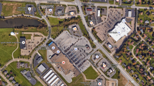
Last year I shared how Google Earth can be used to understand parking utilization. In response, readers suggested that Google Earth can be used for walking audits and offered that Remote Sensing Metrics is another resources for parking utilization data. Patrick Holland, a Master’s in City and Regional Planning student at Ohio State University, Gala Korniyenko, a Master’s of Urban Planning student at the University of Kansas, and Brittany Port, an Ohio State University graduate of the Master’s in City and Regional Planning program, along with myself, looked at Google Earth image after Google Earth image to understand parking utilization at large scale retailers.
Retail Parking: A View from Google Earth